.jpg)
Google Earth-ing Tasmanian Logging
 Forest advocates in Australia unveiled a new online tool for demostrating the impact of woodchipping in Tasmania.
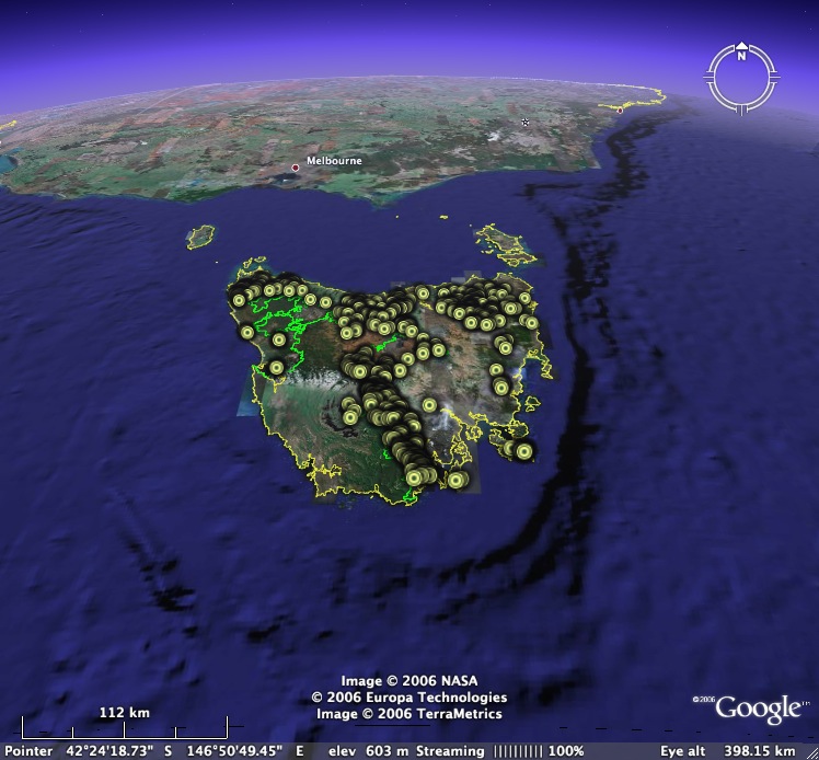
The software program is a unique combination of the global satellite imagery program Google Earth and Forestry Tasmania's logging plans, and gives a bird's eye view of the logging year ahead.
For the first time, people the world over can access the virtual reality of proposed logging in Tasmania via the internet. Technological developments now give us previously unseen viewpoints, and linking these to Forestry Tasmania's website provides alarmingly graphic illustrations of the scale of woodchip driven landscape change in Tasmania.
"These images highlight the close proximity of logging operations to The Tasmanian Wilderness World Heritage Area. They also clearly show industrial scale logging and landclearing across the state, especially in the proposed wood supply zone for Gunns' Tamar Valley pulp mill," said Paul Oosting, spokesperson for The Wilderness Society.
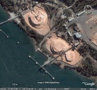 The Google Earth program also has a graphic flyover which instantly transports the user from Gunns' export woodchip facilities in Tasmania to the factories of their Japanese customers.
The program will be available for live access today on The Wilderness Society's website.
 The Google Earth program also has a graphic flyover which instantly transports the user from Gunns' export woodchip facilities in Tasmania to the factories of their Japanese customers.
"A trip from a Tasmanian woodchip mill to the yards of Japanese paper makers highlights the reality of the export woodchip industry. Huge piles of Tasmanian native forests lay piled on wharves awaiting export or processing," concluded Mr Oosting.
The program will be available for live access today on The Wilderness Society's website.


1 comment:
I'm reading a book on Google Maps Ernie bought me. They've made it quite easy to do this sort of thing; especially since they write the JavaScript libraries. The big question, though, is if it will be free and ad-free forever of just how they plan to "monitize" this service.
I look forward to playing with it on the HW website later this month.
Post a Comment